Calimoto - A Smarter Route, GPS, and Tracker

I have tried many different app that will create routes, track your route, record you route, and a host or other options. The problem is that each one always seemed to fail in one major category (or another) making it difficult to use. Every time I find a new program to use, I give it a try (free of course) and am usually disappointed. I usually fall back to using my TomTom and Google maps.
About 6 weeks ago I read about the Calimoto app. I was particularly intrigued by the fact that is has both an app (for your phone) and and online version (for you desktop/tablet). One huge feature I love about my TomTom GPS is that it also has an online feature (for you desktop/tablet) that allows me to create routes, save places, import GPX files, etc AND all of those changes magically appear on my GPS. I do not need any special software (like a Garmin). I can do it all via a browser. This has saved me tons of frustration and is VERY flexible. Since Calimoto ALSO had this feature, I decided to give a try.
Calimoto has both a Free version AND a Paid version. Even with Free version, it has plenty of options available for a fair evaluation. You also have an option for a free trial period with the Paid version (14 days). I decided to go ahead and download the app to my Android phone and registered for a new account.
Before we go any further, you must understand that the goal of this app is to create routes but by NOT using any of the major roads (like interstates). You cannot customize this feature. The program is designed for a rider to be able to create a new route that does NOT take straight roads but concentrates on winding and twisty roads. Yes, you can plot a route from Charlotte to Greensboro (like with Google maps) but it will not be the fastest route rather the most "fun" route.
This app uses some winding road algorithm. So if you are in a hurry, use Google maps or some other GPS. Calimoto is designed for those who love to ride and are not in any hurry to get there. So let me hit the highlights from the Free version and why I like this program.
Round Trip Planner
This is by far the coolest feature! From any starting point (lets assume you are at home), you select the Round Trip Planner. You must enter the starting point (you can default to the current location). You select the total number of miles you want to ride, the routing profile (winding or twisty - sorry, this option not available on the desktop), and which direction to head (or leave it to select a random direction). Once you enter those parameters, a ride will be mapped out for you. Here are 3 examples where I put in my address, 60 miles, and a North to North East direction.
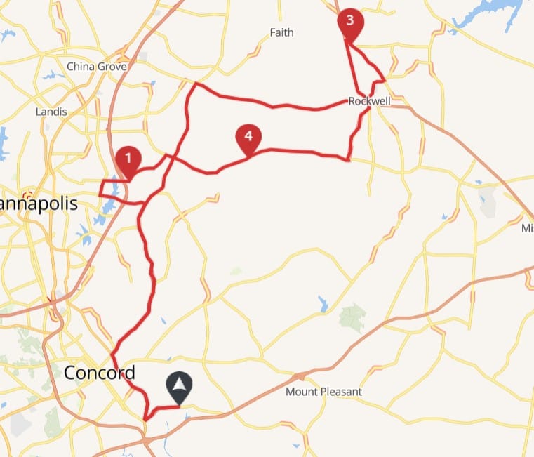
Three totally different routes using the same Round Trip parameters
You can see it selects a different route each time. Do not like what you see, click the recalculate button and another will be created for you. But it does not stop there. If you sort of like the map but want to modify it a bit, drag one of the points to another location and it will re-route. You can also add new points. I think this feature of random round trip routes is fantastic. There are many evenings I want to go ride and I just use this option. Of course you always have the option of saving the route to ride it some time in the future.
Trip Planner
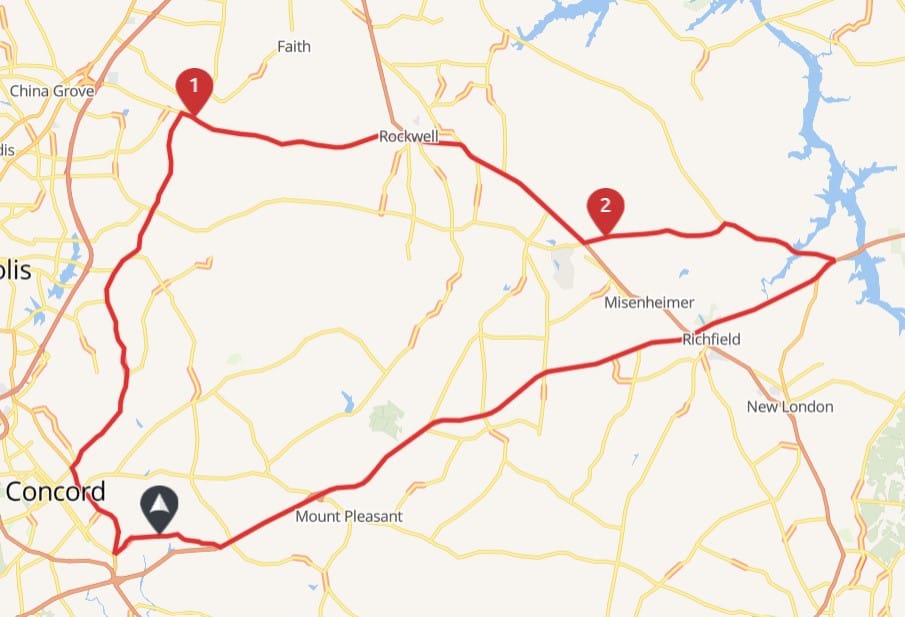
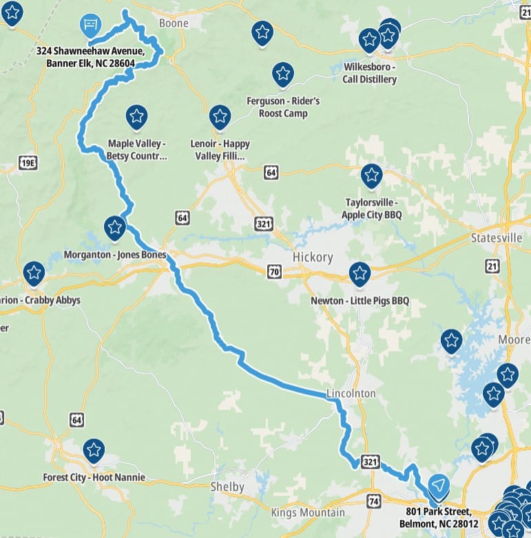
This feature is more like Google maps in that you enter a starting point and a destination and it will calculate the route for you. This is a One-Way route (of course you can add more points to the route and make it a round trip is you want. I put in my house to Tamarac Marina and this is the route it created for me.
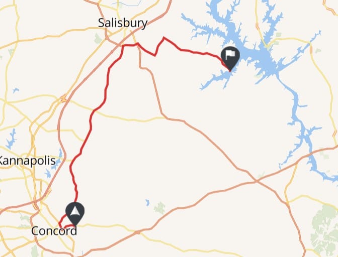
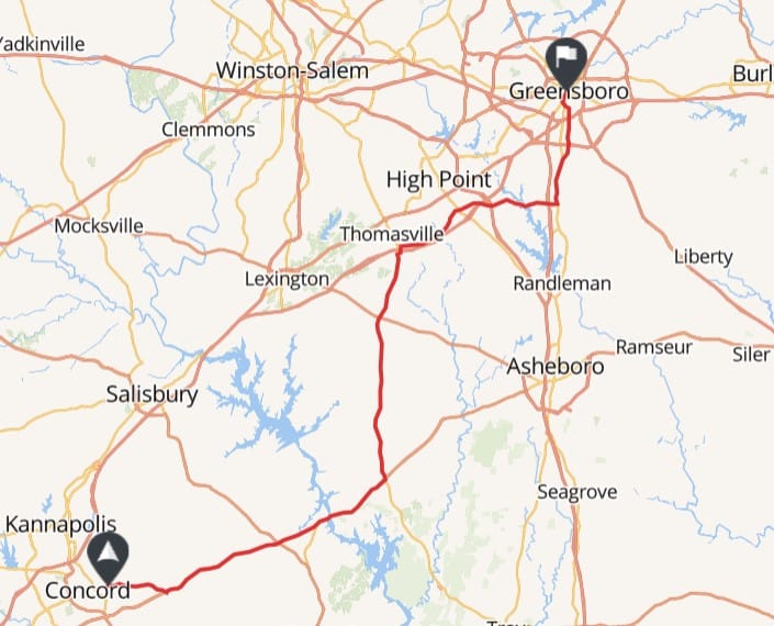
To make it a bit more interesting, I put in the starting point as my house and Greensboro as the destination. It is hard to tell on this map but not one major road was used in the navigation.
The desktop version does not allow you to select the type of ride like the app does. You have four options: Winding, Twisty, No Highway, Fast. So if you are in a hurry, you can select the Fast option and it WILL use the highways to get you there much faster BUT I do not see the point. I would just use Google maps. It is just nice to have the option available if needed.
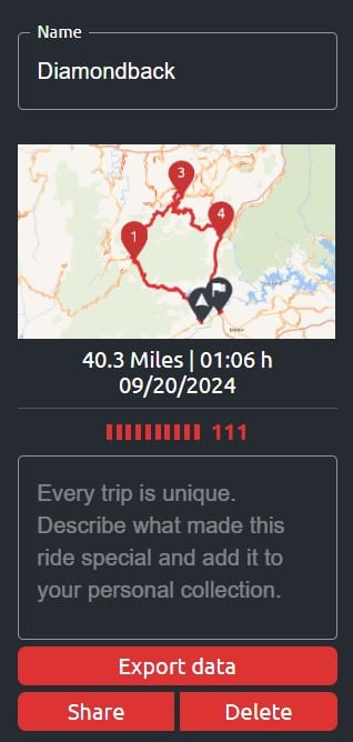
Something else interesting about the mapping feature is the Calimeter. It rates on a number scale the "twisty" factor. On this ride from Concord to Greensboro, the Calimeter was 12. On a previous route on the Diamondback, the Calimeter was 111.
Save Routes
With either the Round Trip or My Trip Planner option, you can always save your route. I like this feature since it is VERY easy to save and allows you to plan trips in advance. Each trip/route is saved under the My Ride section of the site/app. You can give it your own name and a detailed description and it will display a small map, length, and time of the ride. You can also see the options for Export, Share, and Delete.
Import/Export
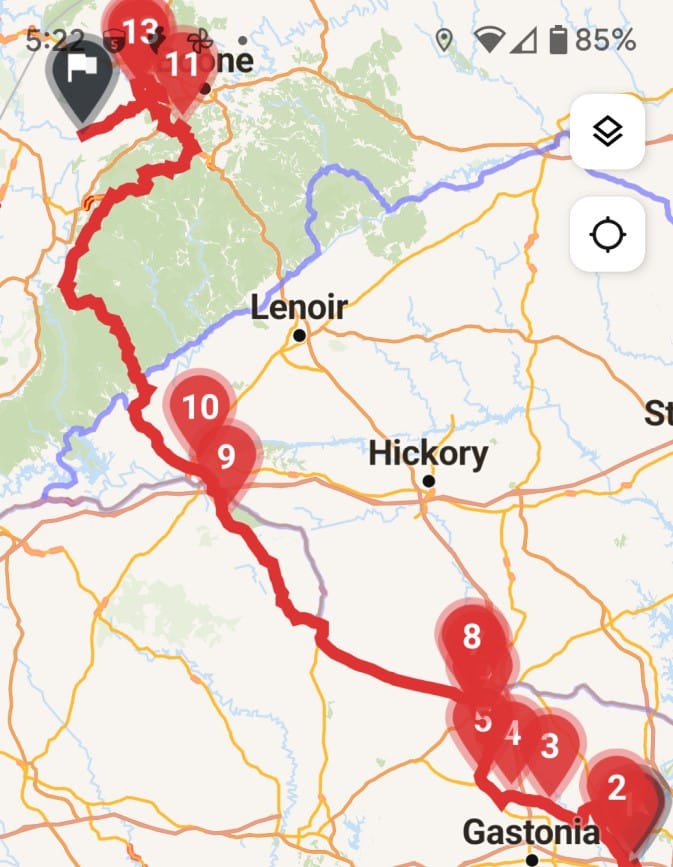
Why bring up importing and exporting of trips and routes? If you have used Google maps, try importing a GPX file and then using it to navigate the route. It doesn't. So many times people want to use the route and they can't. I am lucky in that my TomTom GPS does import and export VERY easily but the trips are on the app. I tried exporting one of my completed round trips to a GPX file and importing it to the GPS. I wanted to see if it was compatible and easy. Here are both maps side by side (Calimoto vs TomTom).
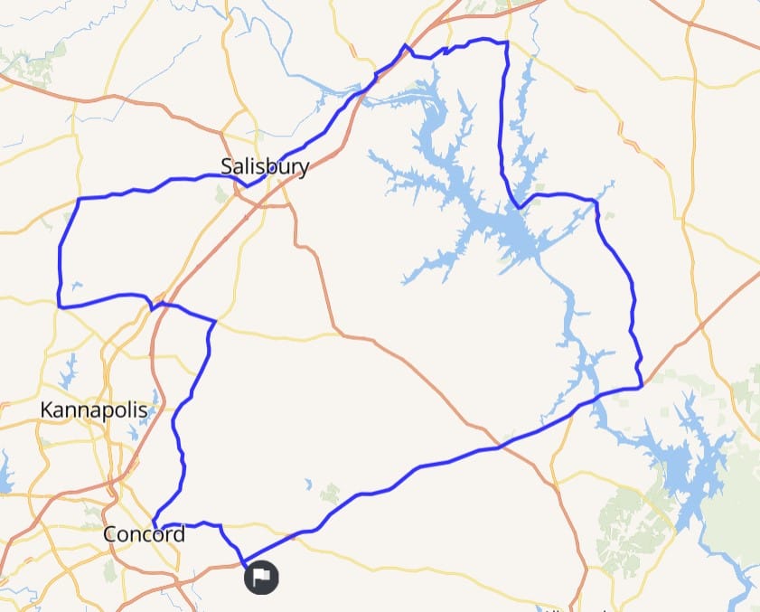
Comparing the export on Calimoto to TomTom
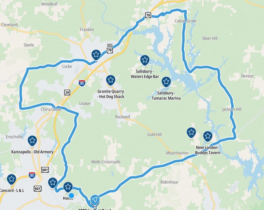
They are the same. So passing a GPX file over to someone else to use is a simple click. But what about the reverse? I have a route on my GPS that I want in Calimoto? The import on the desktop is not nearly as good as the app as can be seen in the comparison (GPS, app, desktop).
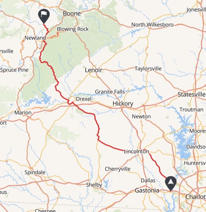
Comparing import gpx results
You can see that the desktop rerouted so that you miss all the good roads in the mountains. I hope that this gets fixed at some point or at least allow an option to tell it NOT to change the route. Just remember, to import, use the app!
Most of the time I am going from Calimoto to some other application so it is not a big deal for me but still, not sure why they are different AND I did submit a bug report on it. I was just glad to see that it is easy to import and export since this has really been an issue in the past.
Record Your Trip
I was happy to see that this app included the ability to record a trip. There have been a number of rides that I have recorded on my GPS since it is an option. The GPS works great but pulling recorded rides off of it to share with others is not one of its strong points.
With this app, click a button to record and that is all you need to do. When the ride is done, you save it and it appears as just another completed ride allowing you to export to anyone. The drawback is that this is a Premium feature.
Favorites
Another nice feature is the ability to add addresses and save as a favorite. Many times I want to do a ride and the ability to pick one of my favorites restaurants is great. There are many places I like to go that are over 30 miles away. I just select the favorite as a destination and it does the rest.
Premium Features
So is it worth upgrading to Premium? It really depends. One of the main features you get with the paid version is Voice Navigation. I have my phone mounted where I can see it while I drive. I do not NEED to have voice but I find it helpful (I have missed so many turns with no voice to tell me). I like the voice navigation along with the visual map.
You also get offline maps. I have not used this feature so I cannot really comment on whether it is worth it or not. I will say that I have been in many situations with no cell coverage and my TomTom GPS was worth its weight in gold. I always use a GPS along with my phone so I have not really ever had a need to download the offline maps.
If you love curves, you may want to purchase this app just to get the "twisty" option. Yes, you only get the default "winding" option with the free version. I have not done enough testing yet to determine if there is a huge difference when selecting that option. If the option works as described, yes, it is worth it.
Some other features I really do not care about are terrain maps, satellite maps, photos along the route (I have that option turned off), and sites/poi. I may start using the POI more if it is helpful. I have not been using it enough to make that determination.
As I mentioned above, recording your ride is a premium feature. I love this option as I do go out with others and I like recording the route so I can remember specific roads, etc. that I really enjoyed.
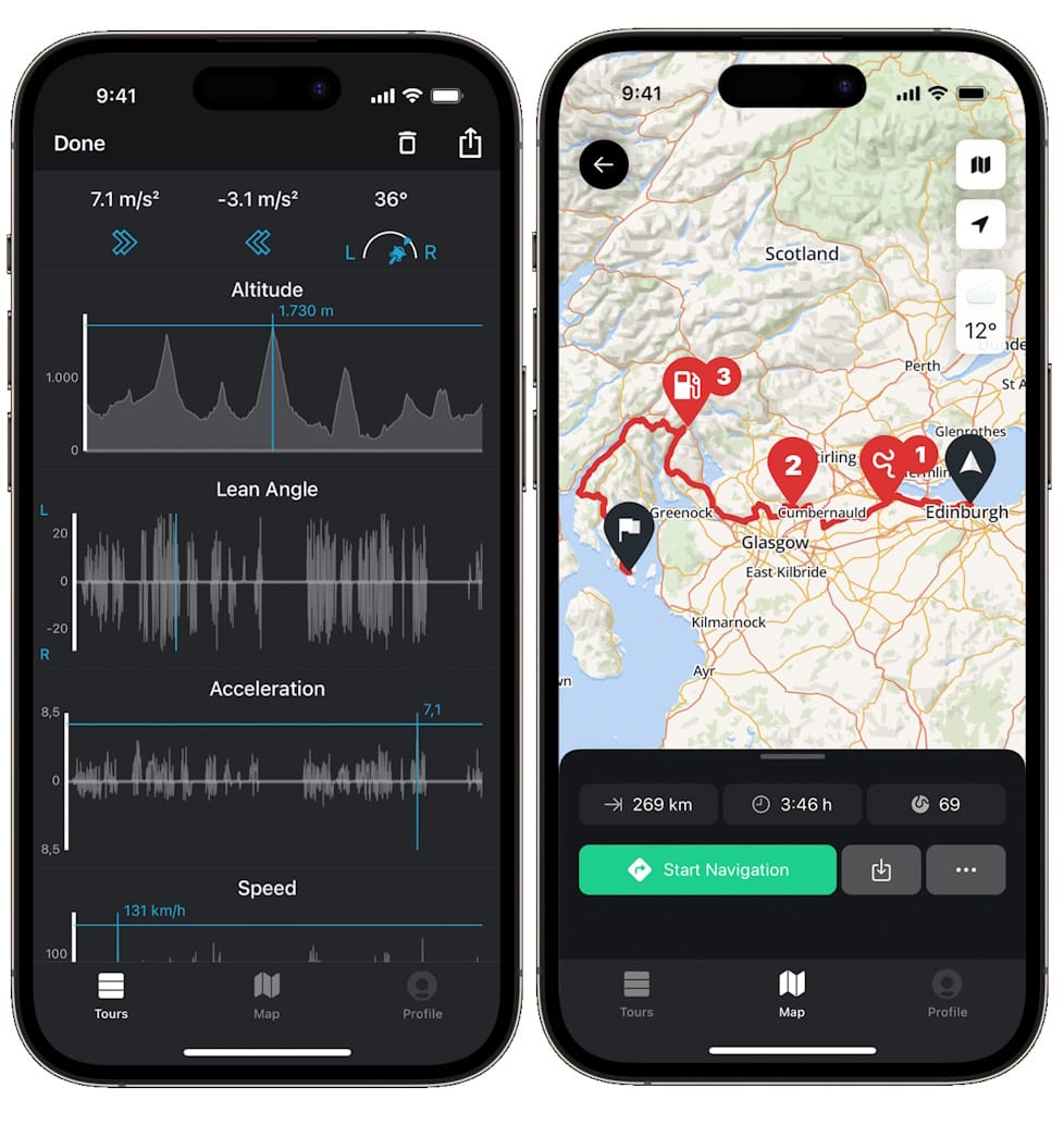
The last premium feature that is actually pretty cool is the ride/rider statistics. Every time you complete a ride, it gathers a number of stats about your ride. For example, it will show you elevation profile, lean angles, acceleration and speed. For the ride as a whole, it gives you elevation gains, max and average speed, speed graph, and altitude graph. Is it something you need? No but it is cool...especially the lean angle.
Summary
Overall I do like this program. I decided to purchase a year for about $40. I will continue to use it and get a better understanding of it. Hopefully they will also continue to improve it as well. I would say it is worth the money but even with the free version, it still provides quite a bit of value.